
Sam Rayburn infrastructure is the first fishing story at the reservoir right now because access, water level, ramp usability, and local planning are shaping the day before anyone makes a cast. On September 9, 2026, Sam Rayburn Reservoir stood at 154.96 feet above mean sea level, about 9.44 feet below its full conservation pool of 164.40 feet, and was listed at about 66.9% full by Water Data For Texas. For bass anglers, weekend families, guides, and small club crews, that number is not just a water statistic. It changes which ramps are realistic, how much time gets spent towing, and how carefully boaters read shallow approaches.
Why Sam Rayburn Infrastructure Is The Story
Sam Rayburn Infrastructure Starts With Access
Every Texas angler learns that a lake can fish big on paper and much smaller at the ramp. Sam Rayburn is one of the state’s major fishing waters, but low water makes the access system part of the competition. A crew can have the right rods, the right electronics, and the right plan for timber, drains, points, or grass edges, but a closed or shallow ramp can burn the first hour of daylight. That matters even more in a fishing culture where early launches set the tone for the whole day.
Texas Parks and Wildlife lists 22 maintained public access areas around Sam Rayburn Reservoir, including parks and private concessions, with boat ramps at those areas. TPWD also identifies management across several hands: 13 parks are operated by the U.S. Army Corps of Engineers, while other access points are handled by the U.S. Forest Service, Texas Parks and Wildlife, counties, or private concessionaires on the agency’s Sam Rayburn access page. That spread is useful because it gives anglers choices, but it also means conditions and local operating decisions can vary by site.
The access page carries the key caution for September 2026 fishing planning: because of low water levels, many boat ramps may be unusable, and anglers are advised to confirm ramp availability with local authorities. That is the most practical sentence in the access picture. It does not say every ramp is closed. It does not give a ramp-by-ramp live status in the research supplied here. It tells anglers the safe play is verification before the truck leaves the driveway.
What The September 9 Water Level Means
Low Water Changes The Launch Plan
The September 9, 2026 reading showed conservation storage at about 1,931,554 acre-feet, compared with a conservation capacity of 2,857,077 acre-feet. For anglers, storage and pool elevation meet at the ramp. A reservoir sitting more than nine feet below full conservation pool can expose shallow ends, change dock angles, narrow usable lanes near ramps, and put more pressure on the access points that still have enough water.
That does not make the reservoir unfishable. It makes the day more technical. A low-water launch plan should account for ramp grade, trailer depth, wind direction, boat size, and how much room exists to idle away from the ramp without crossing hazards. The research supports the broad access warning, not a full list of confirmed open ramps on September 10, 2026. So the strongest recommendation is simple and factual: check with the managing office or local authority for the specific ramp before going.
Sam Rayburn infrastructure sits at the center of that decision. In higher water, many anglers can choose a ramp mostly by fishing area. In low water, the first question becomes whether a ramp can safely handle the boat. The second question is whether that ramp still keeps the crew close enough to the intended fishing water to make the run worthwhile.
How Ramp Networks Shape The Fishing Day
Public Access Is Not One Single System
The 22 maintained public access areas around Sam Rayburn give the reservoir a broad community footprint. They serve bass anglers, crappie anglers, families, campers, tournament teams, kayak users near suitable shoreline spots, and visitors who simply want a lake day. Because the sites are not all run by one operator, local knowledge becomes part of responsible planning. One park may have a different ramp profile, parking setup, fee process, or low-water threshold than another.
That kind of infrastructure can decide fishing pressure. If several ramps are questionable, more boats may concentrate at the most usable access points. That can change takeoff flow, parking demand, wait times, and the first decision on where to fish. A local angler who knows which ramp has enough depth may gain a time advantage, not because of secret fishing water, but because the launch plan is cleaner.
That is familiar to me as a redfish angler on the coast, where a tide-gutted launch or a wind-pushed shoreline can change the whole day. The species and setting are different at Sam Rayburn, but the sports lesson is the same: access is part of performance. The best fishing plan starts before the first cast. For readers comparing on-water adjustments with access planning, this related look at Sam Rayburn low water bass tactics fits the same practical conversation.
- Verify the specific ramp with the managing authority before towing.
- Build extra time into the morning for a possible ramp change.
- Match boat size and trailer needs to the ramp conditions reported locally.
- Expect pressure to build at the most usable access points during low water.
Community Planning Around Low Water
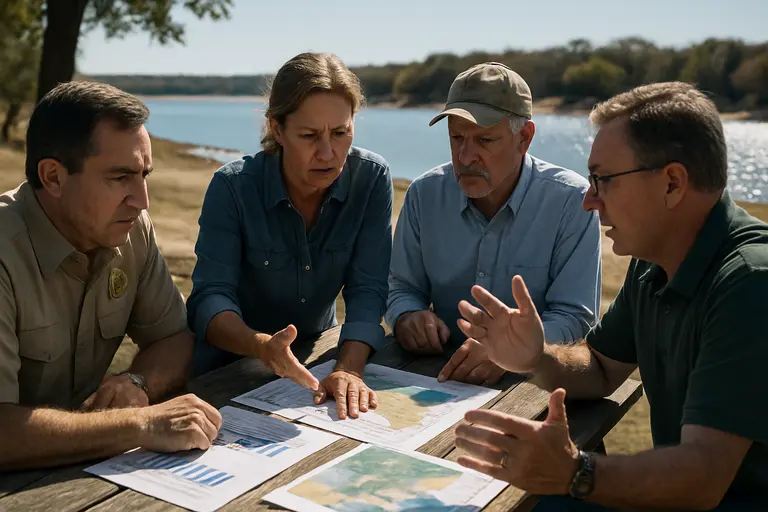
Confirm Before You Tow
Low water is not only a fishing issue. It is a community issue around Jasper, Brookeland, Zavalla, Huntington, and the broader Sam Rayburn area because lake traffic supports bait shops, fuel stops, cafes, campgrounds, repair shops, and local tournament routines. When anglers change ramps, delay trips, or shorten runs, those choices ripple through the lake economy. The confirmed facts here point to the same practical need: clear access information matters.
The current water level also raises a communication challenge. Anglers often trade ramp reports through text chains, tackle counters, and parking-lot talk. That local network is valuable, but official confirmation remains the safer standard because low water can change usability and safety margins. A ramp that worked for one smaller boat may not be right for a heavier rig. A report from last week may not fit the lake level and traffic pattern on September 10, 2026.
For the wider Texas outdoors community, sites such as Back2Tap provide crucial insight on how to maintain safe and effective outdoor experiences. They help keep practical outdoor conversations connected across the same network of readers who care about access, safety, and local conditions. At Sam Rayburn, that community-first mindset matters because the reservoir is too important to treat ramp status as an afterthought.
The strongest local habit is a two-step check. First, read the lake level and understand how far below conservation pool the reservoir stands. Second, confirm the exact access point with the office, concessionaire, county, or agency tied to that ramp. That may feel basic, but basic planning protects the day. It also reduces congestion caused by anglers arriving at unusable ramps and then relocating in a rush.
Sam Rayburn Infrastructure And Local Fishing Decisions
Sam Rayburn infrastructure now frames how anglers should think about every trip to the reservoir. The fishing water remains a major Texas destination, but the September 9, 2026 water reading shows a lake well below full conservation pool. The access system remains broad, with 22 maintained public access areas and multiple managing entities, yet TPWD’s low-water warning means those ramps cannot be treated as equal options without checking first.
The fishing analysis is direct. Low water rewards anglers who plan like competitors, even on a casual Saturday. That means reading the water data, confirming ramp status, picking a backup launch, and understanding that access pressure can shift fishing pressure. It also means respecting the uncertainty in the available public information. The research supports caution at many ramps, not a verified open-or-closed status for each access point on September 10, 2026.
For the local fishing culture around Sam Rayburn, infrastructure is not separate from the sport. It is part of the sport. A good ramp, a clear access update, and a safe launch lane help anglers spend more time reading points, cover, bait, wind, and boat traffic. When the lake is low, those basics carry extra weight. The anglers who adjust first will usually fish cleaner, safer, and with less wasted daylight.